|
||||||||||||||||||||||
|
Air dispersion modeling software (Dispersion
of pollutants of products of combustion.) Snapshots of
advanced Environmental Impact Assessment (EIA |
||||||||||||||||||||||
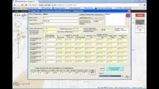
| Watch stack dispersion modeling software Demo on YouTube |
Download or view demo
videos HD quality use Google chrome browser. |
|||||||||||||||||||||
|
Stack Dispersion Module (EIA) 3:18 |
|
Air, gas, Stack gas dispersion modeling software
|
||||||||||||||||||||
|
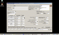
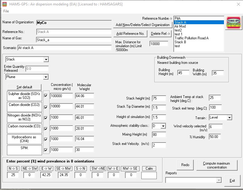
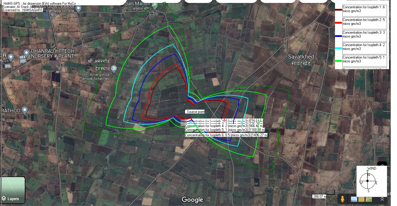
Advance air dispersion modeling software (Gaussian air dispersion modeling), fully conforming to “Assessment of Impact of Air Environment: Guidelines for Conducting Air Quality Modeling”, Programme Objective Series: PROBES/70/1997-98, The Program -[Options: any Time EIA. covers Stack Dispersions under Stability Class for data used and includes Stack Gases covered under Ambient air Quality Monitoring Standards Published in Gazette No-660 dated 16th November, 2009 namely: SO2, CO2, NO2, CO, CH4, SPM<10 mcr, SPM<2.5 mcr, Pb, O3 with Standards under Industrial, Domestic and Sensitive locations. Maps in any Orientation of Wind. It has also Plotting for ISO-Concentration Contours in 8-Orientation Options to compute concentration reached at ground level from release point Plume or Puff from:
i. Graphs can be plotted to scale on Site Maps Air dispersion studies are needed to understand and manage air quality by predicting how pollutants spread from their source. This helps in various aspects, including environmental impact assessments, developing air pollution control programs, and ensuring compliance with air quality regulations.
2. Regulatory Compliance
and Environmental Impact Assessments:
3. Developing and
Evaluating Control Strategies:
4. Optimizing Industrial
Processes and Facilities:
5. Supporting Research and
Monitoring:
In essence, air dispersion
modeling is a crucial tool for managing air quality, ensuring compliance
with regulations, and protecting human health and the environment. |
||||||||||||||||||||||
|
|

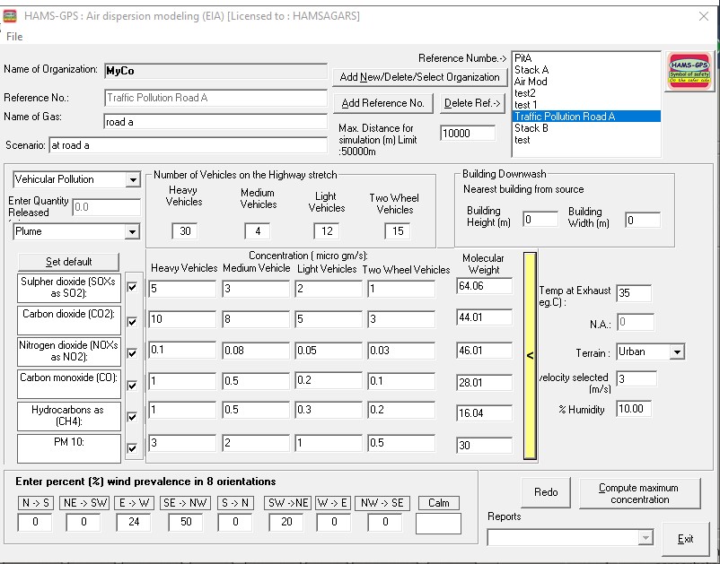
Environmental
Impact Assessment (EIA
|
|
Environmental
Impact Assessment (EIA
|
|
Environmental
Impact Assessment (EIA
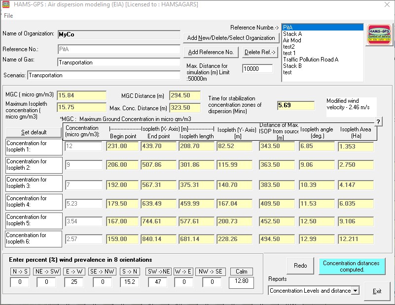 |
EIA module showing concentration distances
|
|
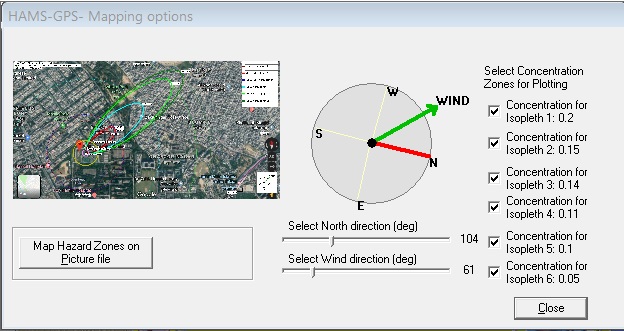
Showing various mapping options and settings
|
|
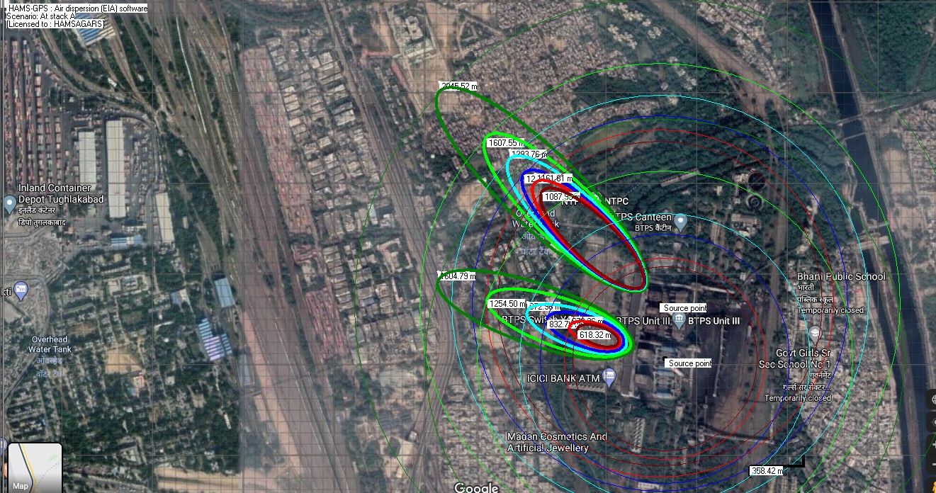
Showing multiple release points can be plotted on picture file.
![]()
![]()